Tirath - The Pilgrims' Trail
The Great Himalayan National Park (GHNP) in Kullu is one of the best-preserved wilderness areas in India. One of its most remarkable treks leads to the Hans Kund spring, regarded by the locals as the source of the Tirthan river. The area surrounding the spring aptly called Tirath, is a significant pilgrimage site for the people of the Seraj region.
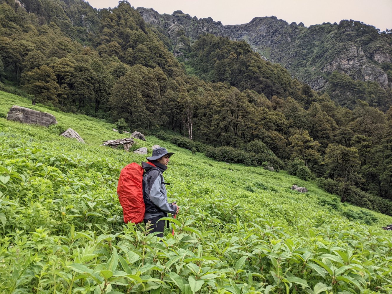
The trek begins near the village of Gushaini and follows a narrow valley carved by the river to reach the high altitude meadow of Tirath. From there, trekkers can either retrace their steps or cross the range to the South of the river to descend into the Falachan valley. Since many trails inside the park remain undefined, hiring a guide is essential. On this journey, I was joined by a local guide and two porters and together we set out to complete the Tirthan-Falachan circuit over six days.
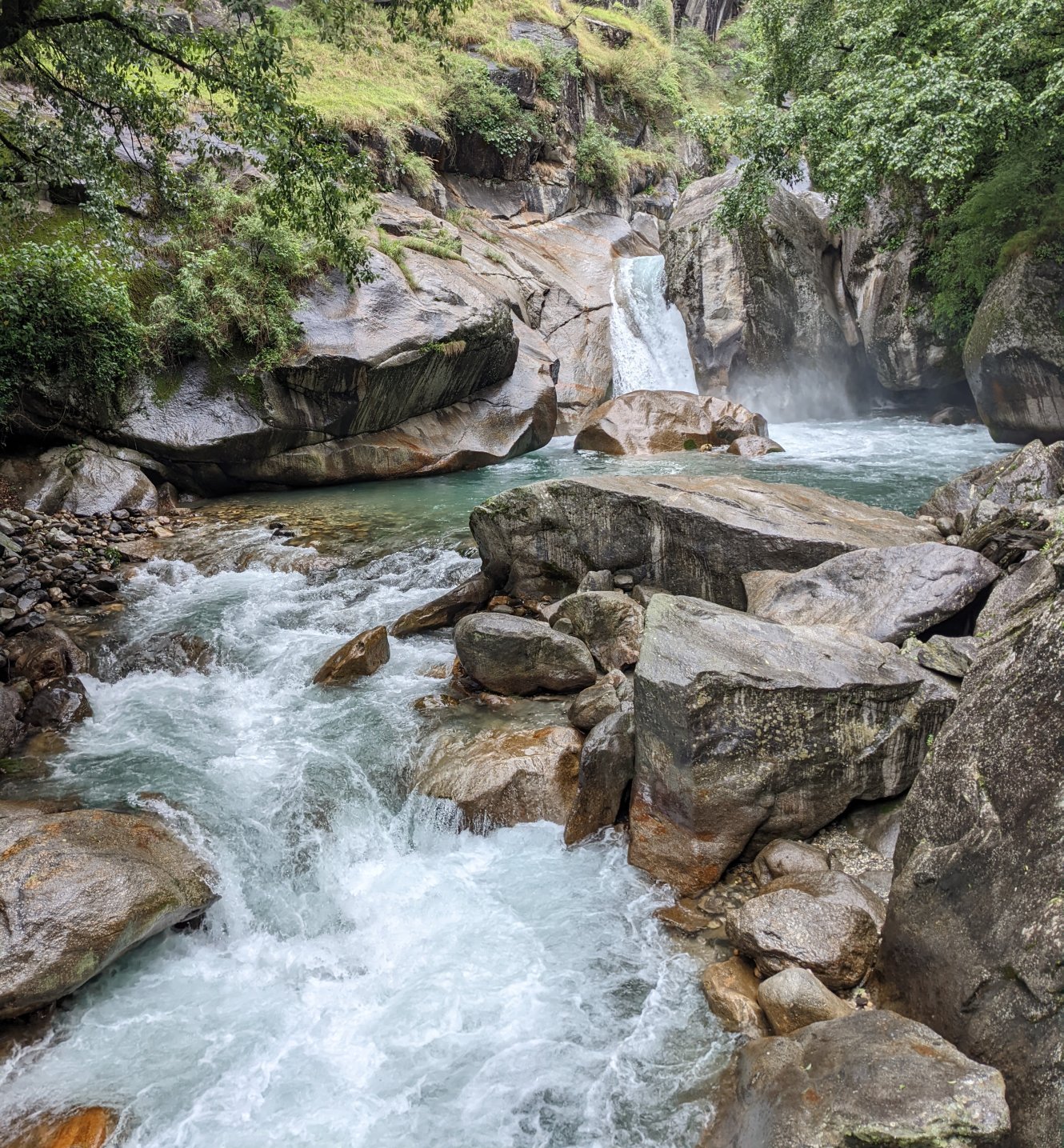 Hippo Falls near the entrance of the National Park
Gushaini to Chalocha
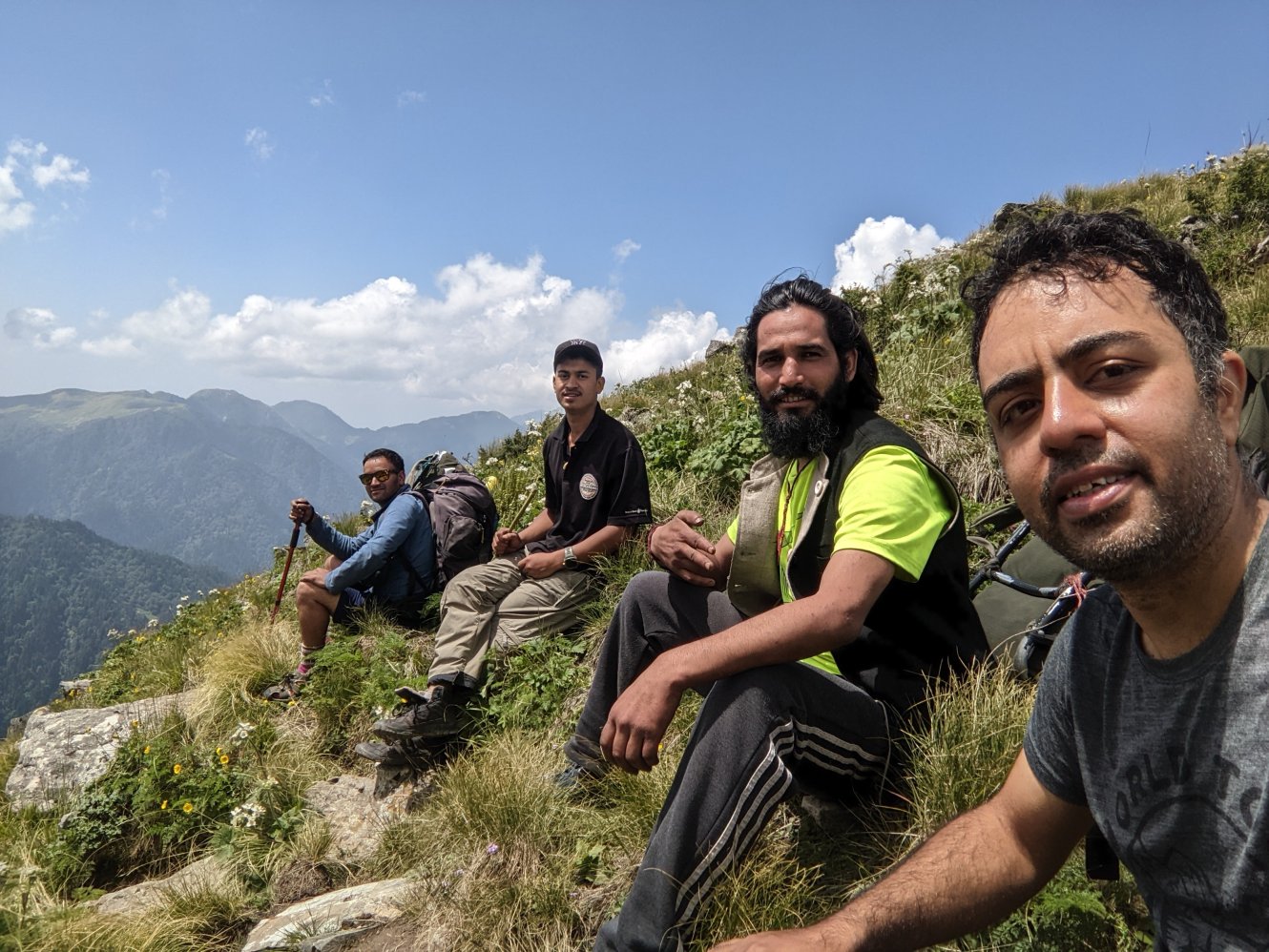
From Gushaini, a dirt road leads to the trailhead near Ropa (1700m). The initial path is wide and relatively easy, tracing the Tirthan River on higher ground. Along the way, we were greeted by a thunderstorm and a heavy downpour that quickly passed. On and off showers accompanied us as we trekked towards Rolla, crossing Hippo Falls and stopping at the park’s entrance gate to have our permits checked.
From Rolla, the trail narrowed and hugged the riverbank that was overgrown with bushes. In some sections where the riverbanks dropped off steeply, wooden bridges had been built to provide safe passage. Elsewhere, the trail ascended sharply away from the river only to descend again closer to the water. During this stretch, we spotted several ghorals at close quarters. We arrived at the Chalocha campsite (2,300m) around 4:30 PM, a serene spot next to a small stream, featuring a forest hut and enough space for a few tents.
Distance covered: ~11 km, easy
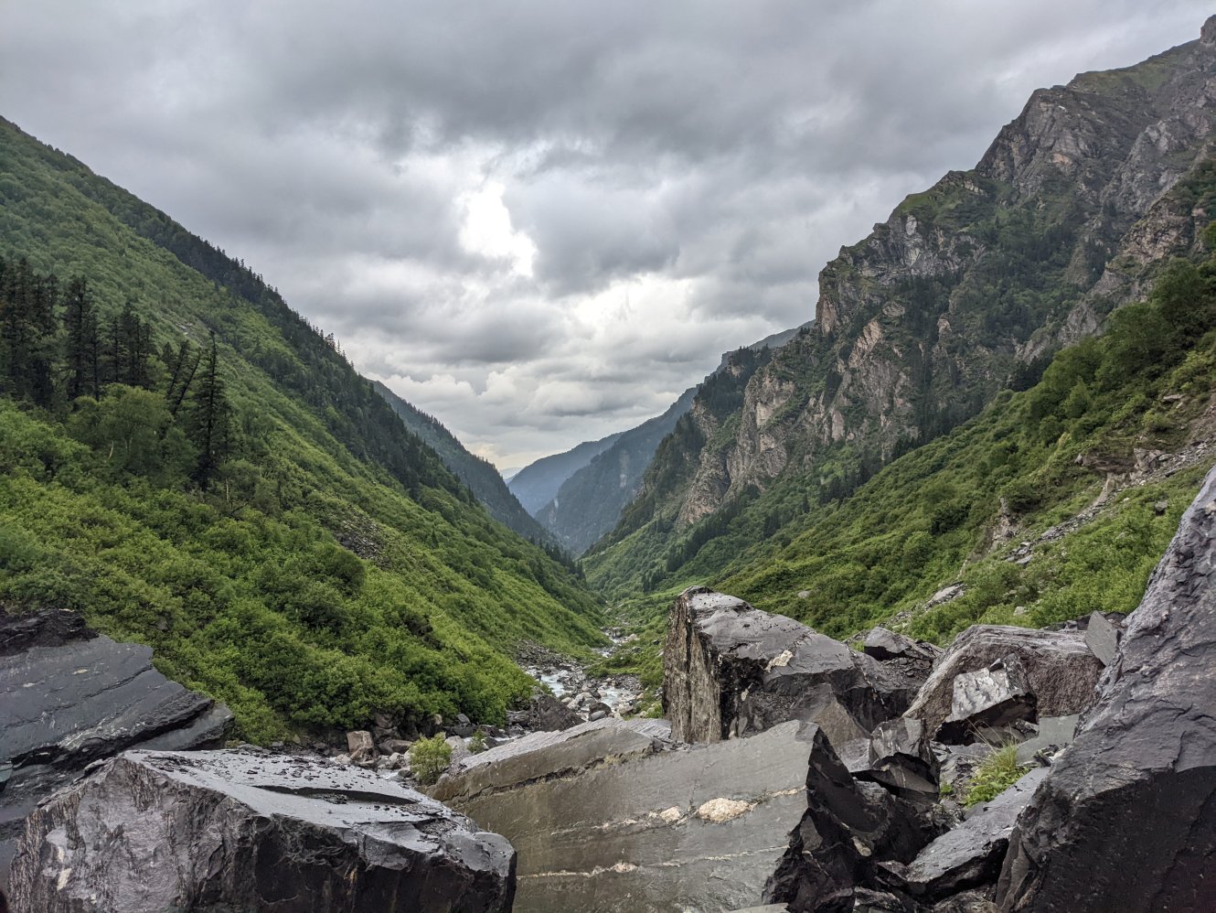
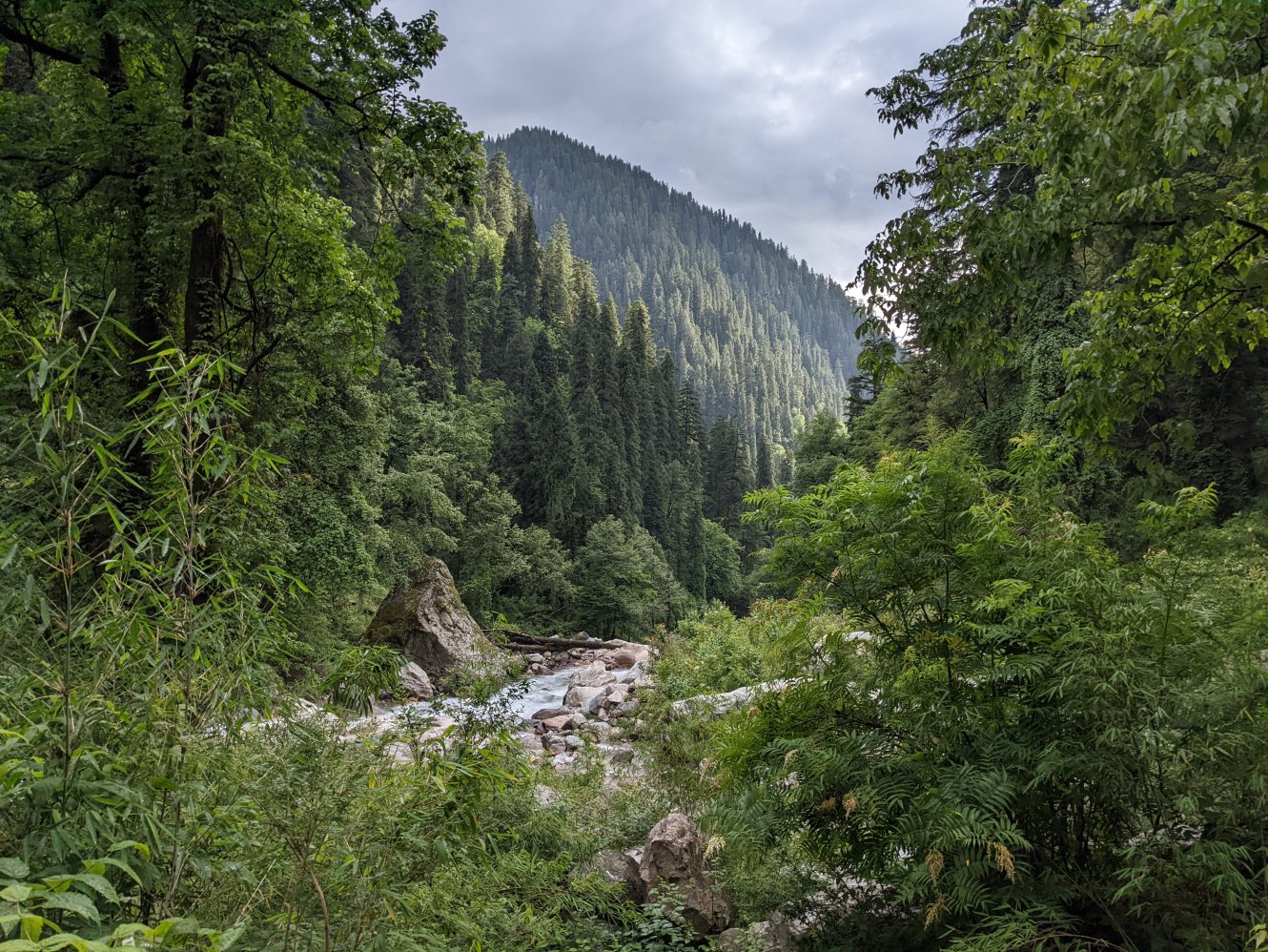 Pristine valley near Chalocha
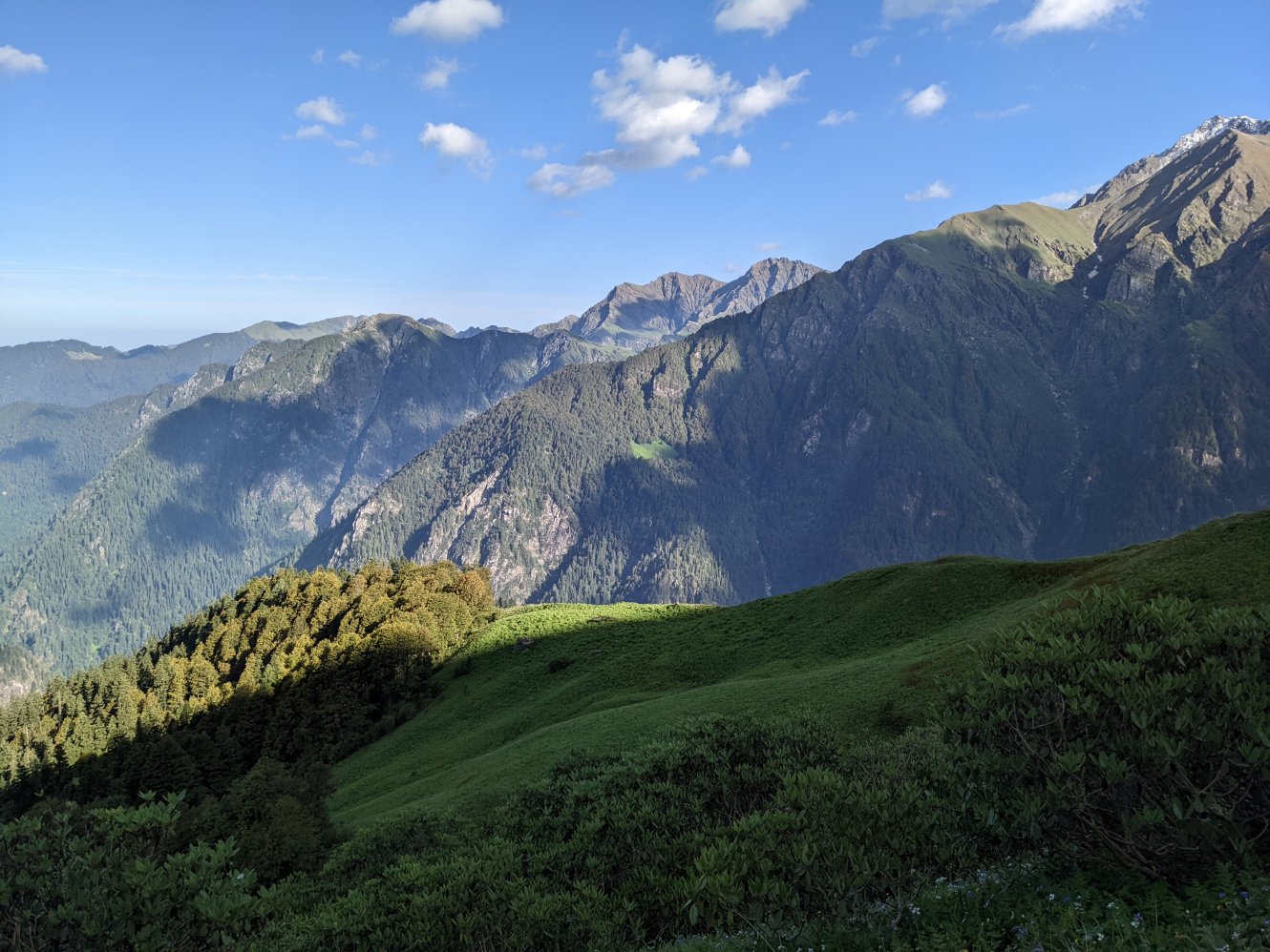
Chalocha to Nada Thatch
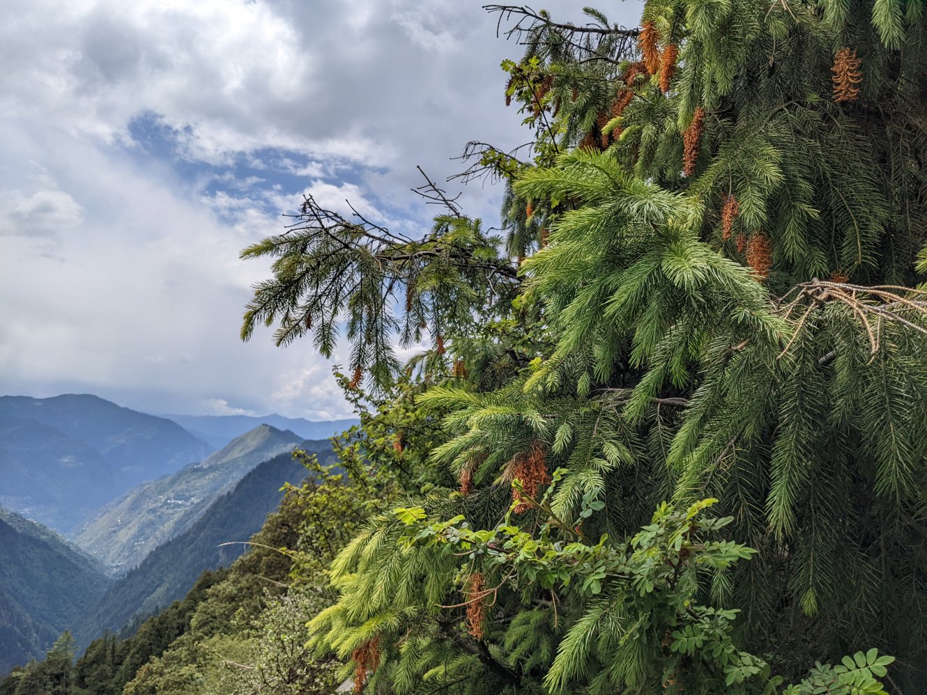
The trail from Chalocha began with a steep ascent immediately after the campsite, weaving through dense deodar trees. The climb was tough but rewarding, with sightings of ghorals and the colorful Himalayan monal along the way. After the halfway point, panoramic views of snow-capped peaks started to unfold. The trail continued to climb until it reached 3,250m, after which it leveled out along an exposed ridge that offered dramatic views, before descending to the campsite of Nada Thatch (3,180m). The campsite is nestled under towering cliffs, where blue sheep and tahr can often be spotted. Birdlife was abundant, and the area was dotted with brown oak and stunted rhododendron trees.
Distance covered: ~2.5 km, steep climb
 Resting point near the end of the climb
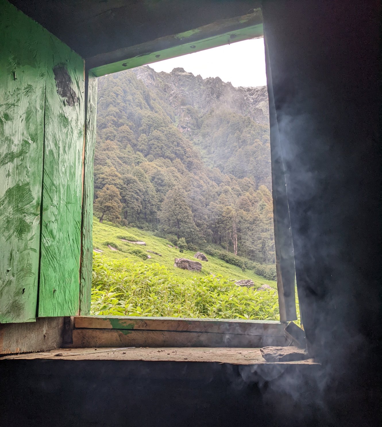 View from the forest hut at Nada Thatch
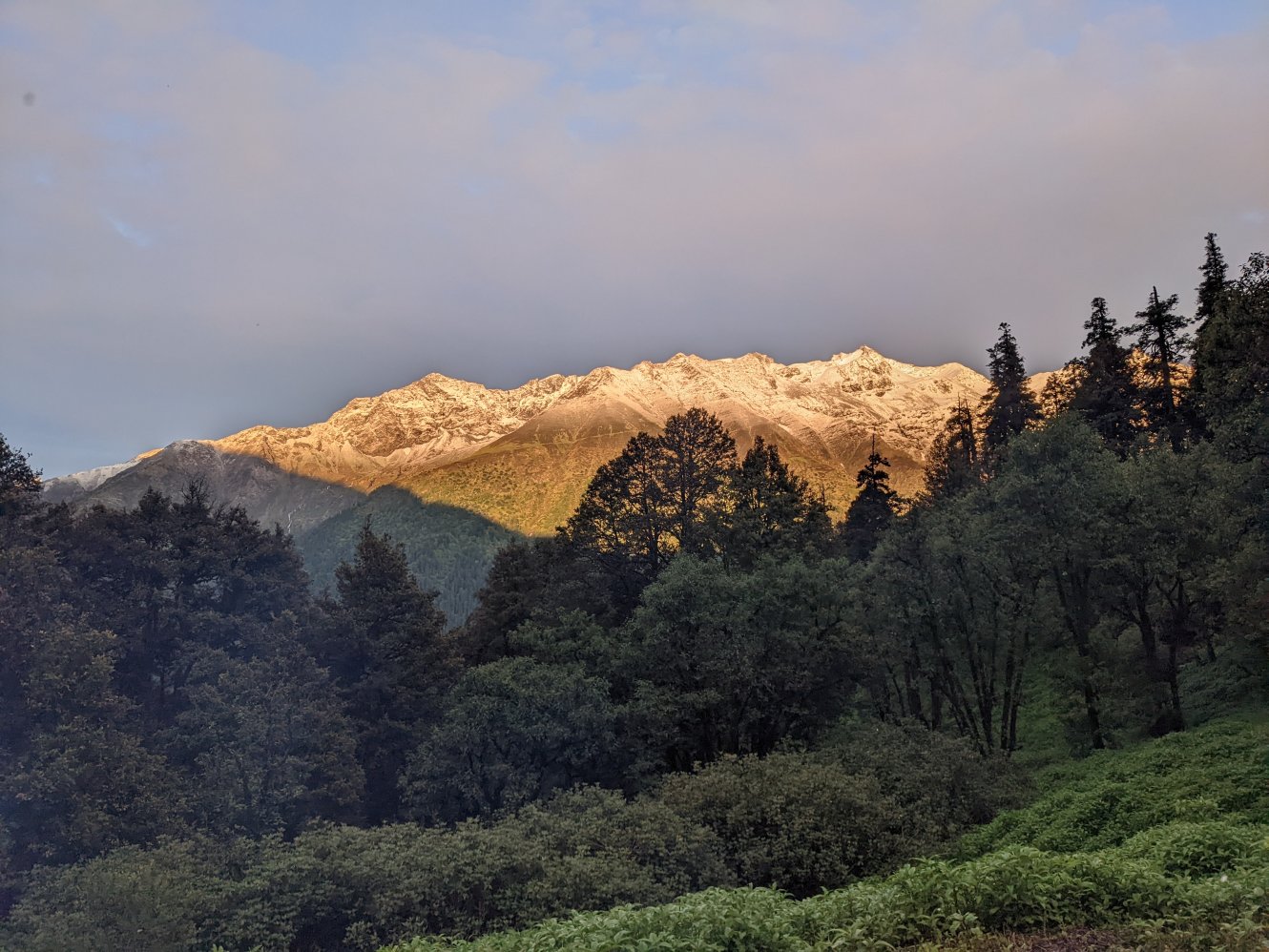 Golden sunset after a thunderstorm
Nada Thatch to Tirath
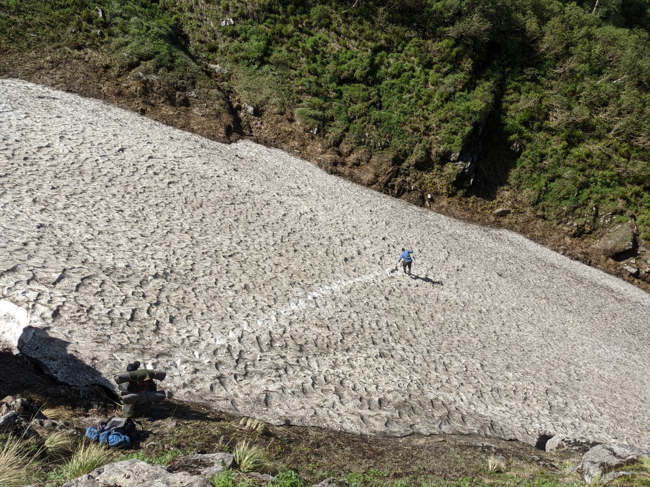
The next morning, a steep descent from Nada Thatch was made even more treacherous by rain, making the already slippery trail quite difficult to navigate. The descent eased at Upla Balu (~2,500m), after which the path became more pleasant, leading us to Shankha (2800m), a site with a large cave, and a good camping area. False strawberries and ruby cinqefoils grew in abundance here. After lunch, we started walking but another downpour forced us to take shelter in a small cave until the rain eased.
We reached the Majhoni campsite (~3500m) but decided to push on to Tirath as there was still some daylight left. The next section of the trek involved scrambling over boulders and navigating areas prone to rockfall. Part of the original trail had been washed away a few years earlier, forcing us to climb roughly 100m up a steep, bushy slope to rejoin a higher path. From there, we walked above the treeline through lush meadows filled with wildflowers, although by then, I was too tired to fully appreciate them. We finally reached Tirath (3750m) around 7:30 PM and spent the night near the Bheem Dwari cave.
Distance covered: ~16 km, hard downhill followed by moderate uphill
 Leaving Nada Thatch
 Looking back towards the Tirthan valley
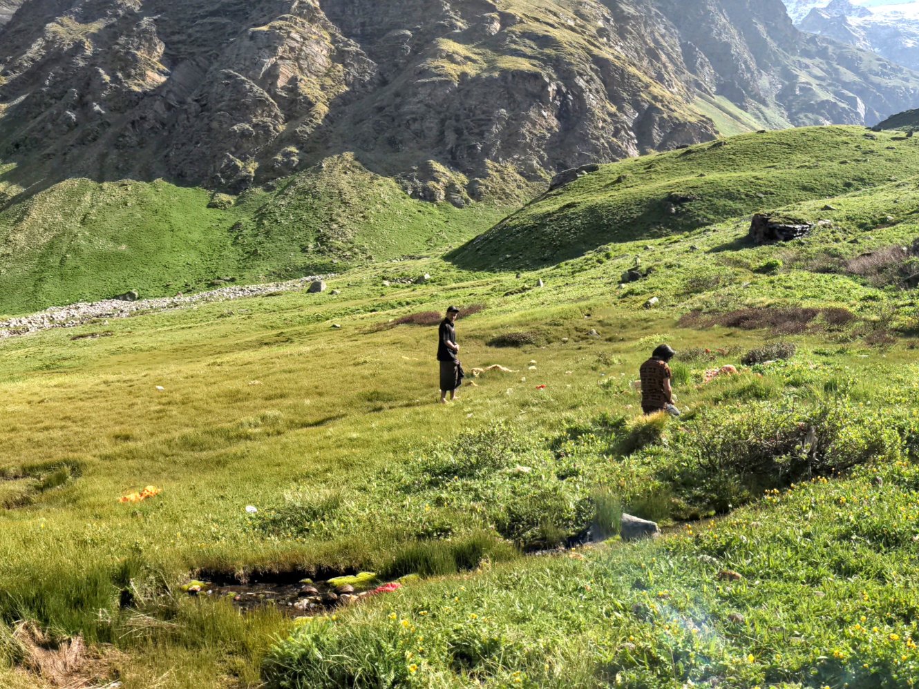
Tirath
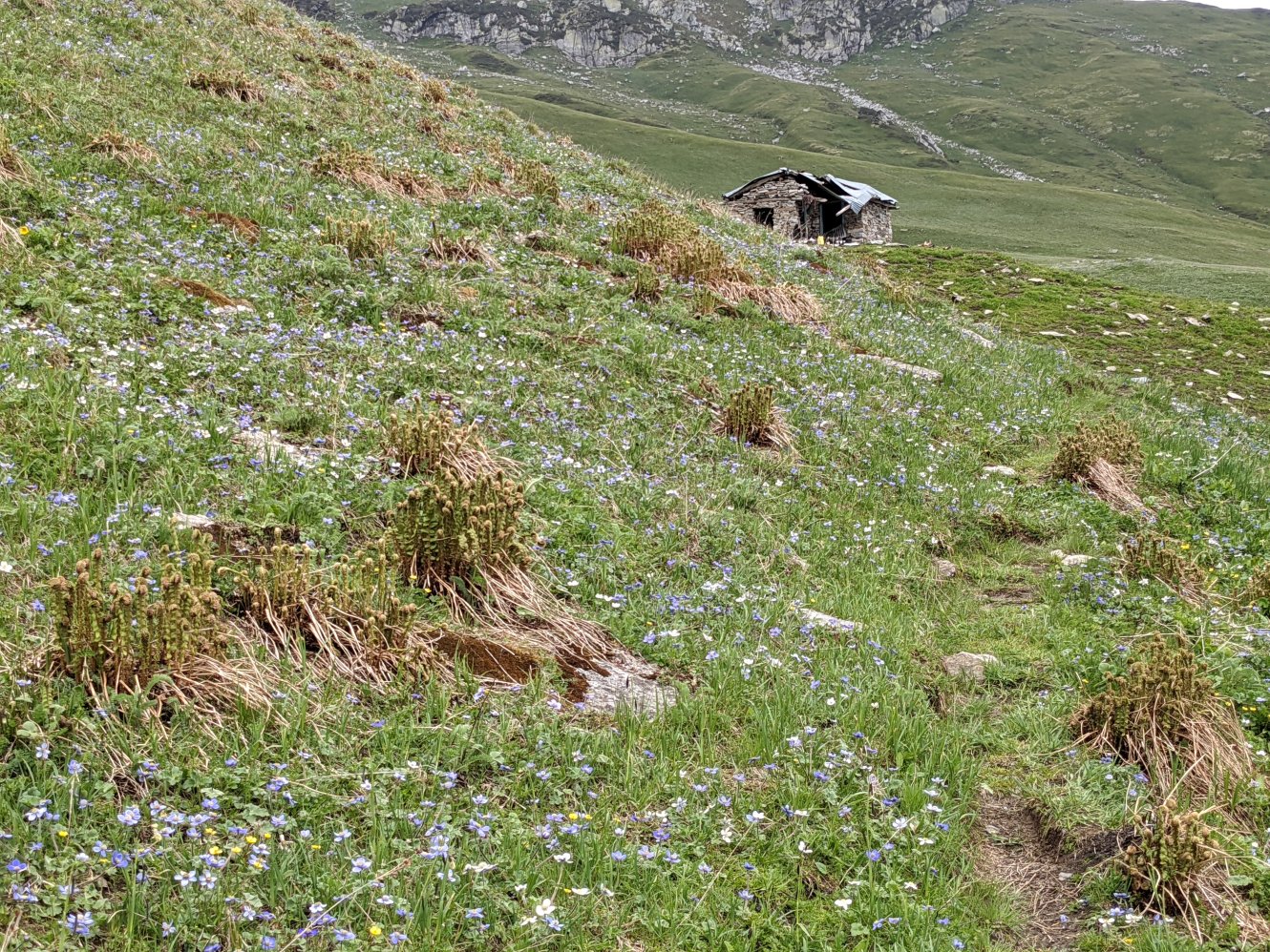
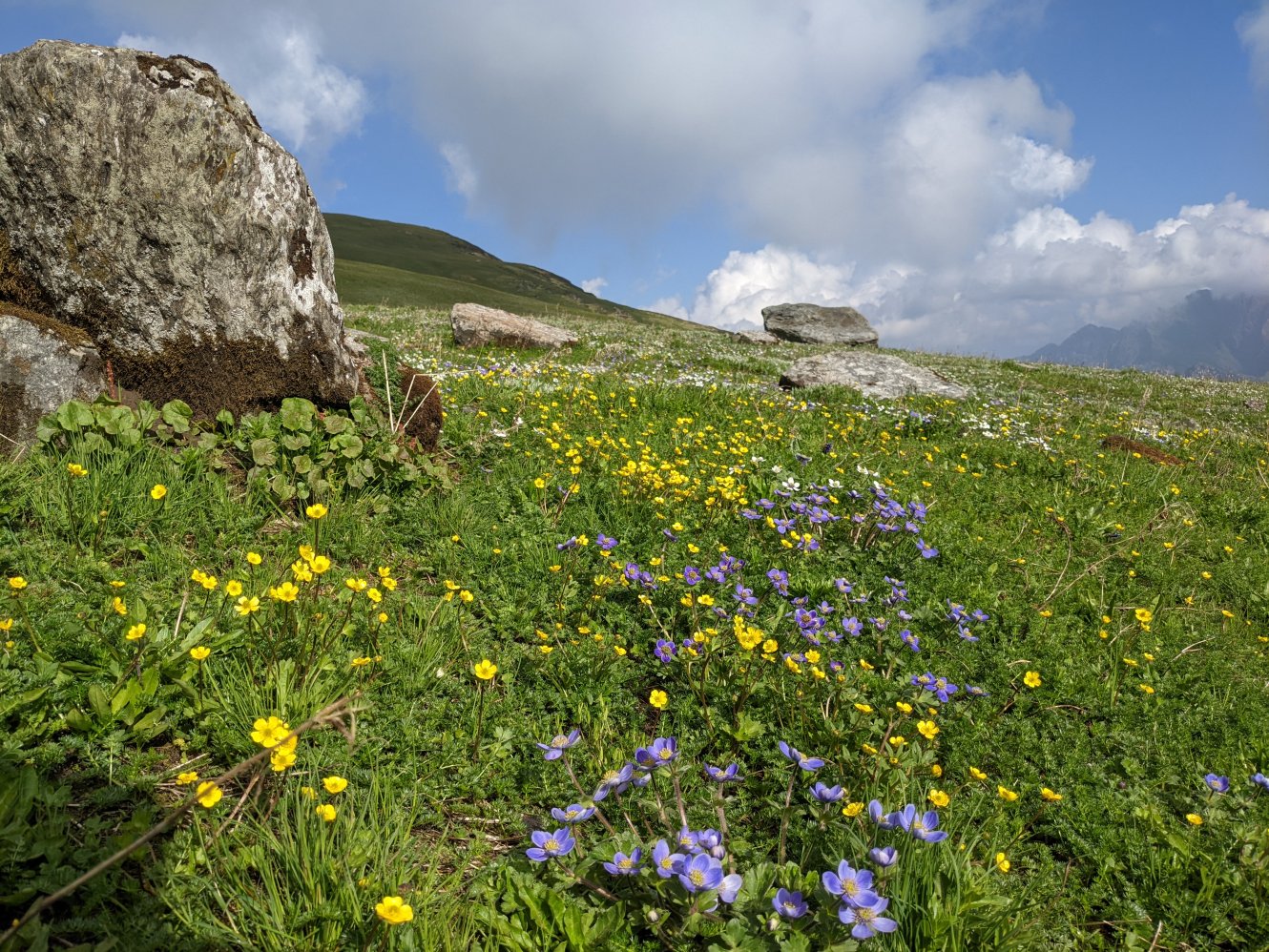
It was only when the sun came out in the morning that could I truly appreciate the beauty and vastness of valley. The sprawling Tirath meadow is flanked by high mountains on all sides, with a dramatic opening to the west, through which the Tirthan flows downstream. The valley floor is covered with flowers, herbs, and a wild grass which resembles wheat. To the east, the meadow splits into two V-shaped gorges from where the river’s two main streams emerge. In spite of that, the locals consider a small, clear water pond towards the eastern side of the meadow to be the true source of the river. As is the local custom, we took a bath in the icy waters of the river before offering our prayers to the local diety. This was followed by a hearty breakfast of chana and halwa before we moved on.
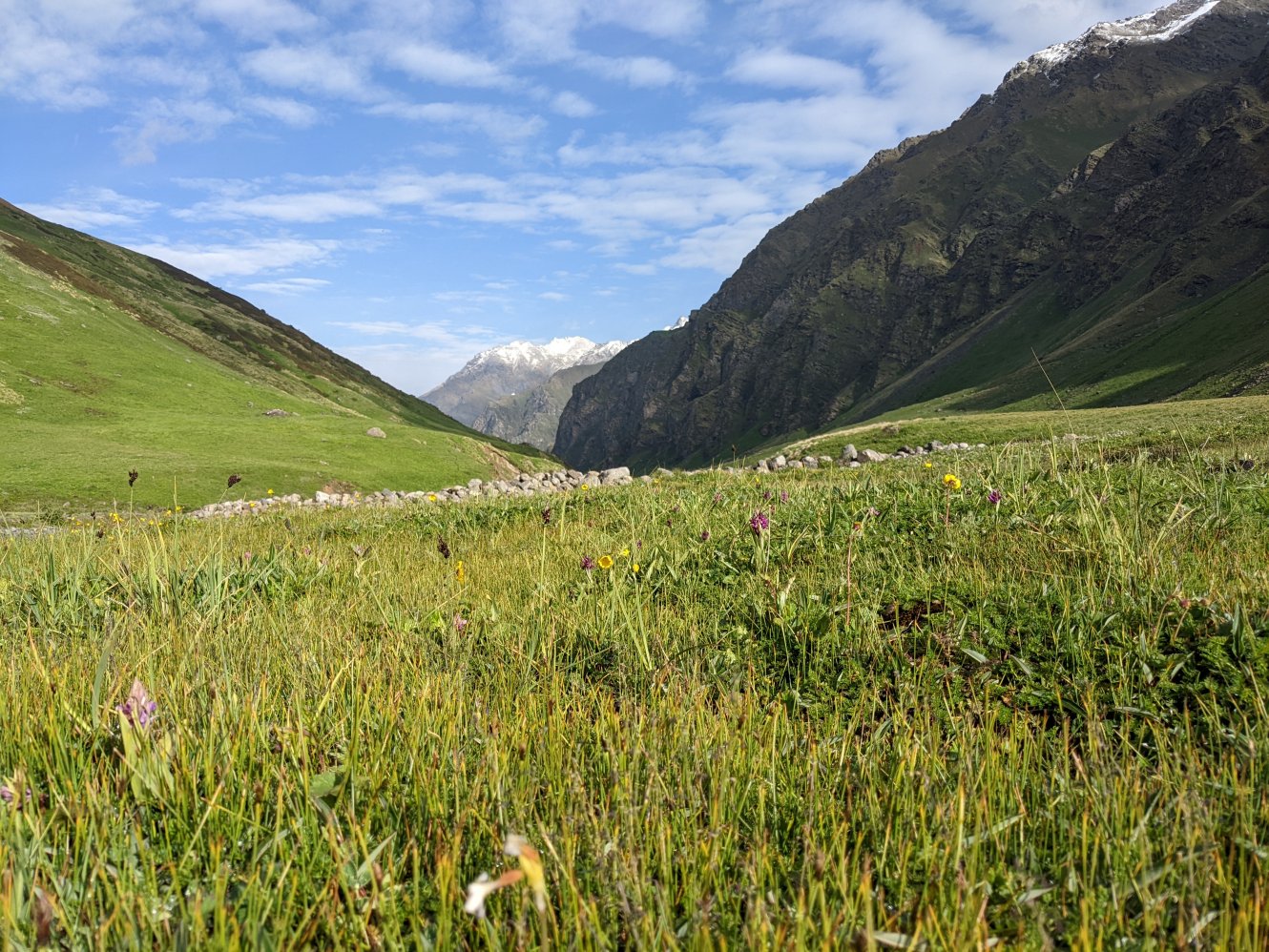 The Tirath meadow
 Praying to the local deity
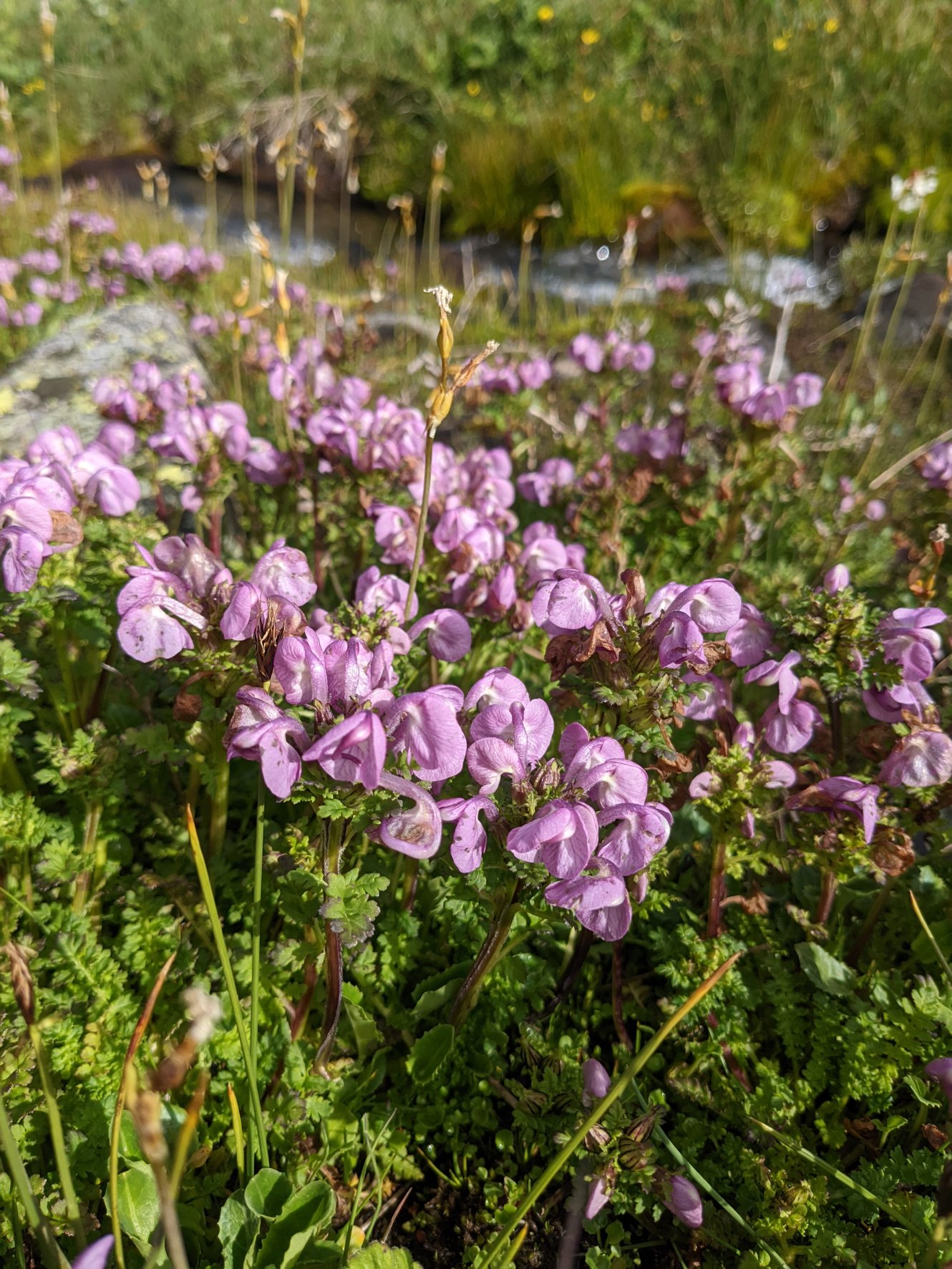 Rattle lousewort flowers in the meadow
Tirath to Jatholi
We crossed the streams that form the Tirthan River to reach the true left of the valley. For the first couple of hours, the trail was steady and pleasant, climbing uphill through meadows teeming with flowers, herbs, and aromatic shrubs. After that, the path became trickier, requiring us to cross multiple rocky spurs and streams covered with snow bridges. After lunch, we were caught in an hour and a half of heavy rain, followed by a whiteout that left us no choice but to wait it out under a rock for shelter. When the clouds finally lifted, we forded a larger stream as the valley widened, followed by a steep descent over mud and loose rocks. From there, a relatively easy walk brought us to a meadow with a small stone shelter, but no water source nearby. We continued for another 20 minutes until we reached a cave at Jatholi (3,560m), where we spent the night.
Distance covered: 10-12 km, easy to moderate with many stream crossings
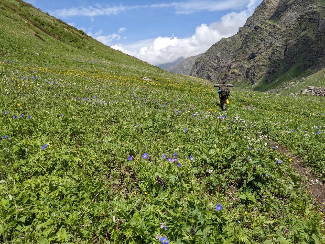 The trail after crossing the Tirthan river
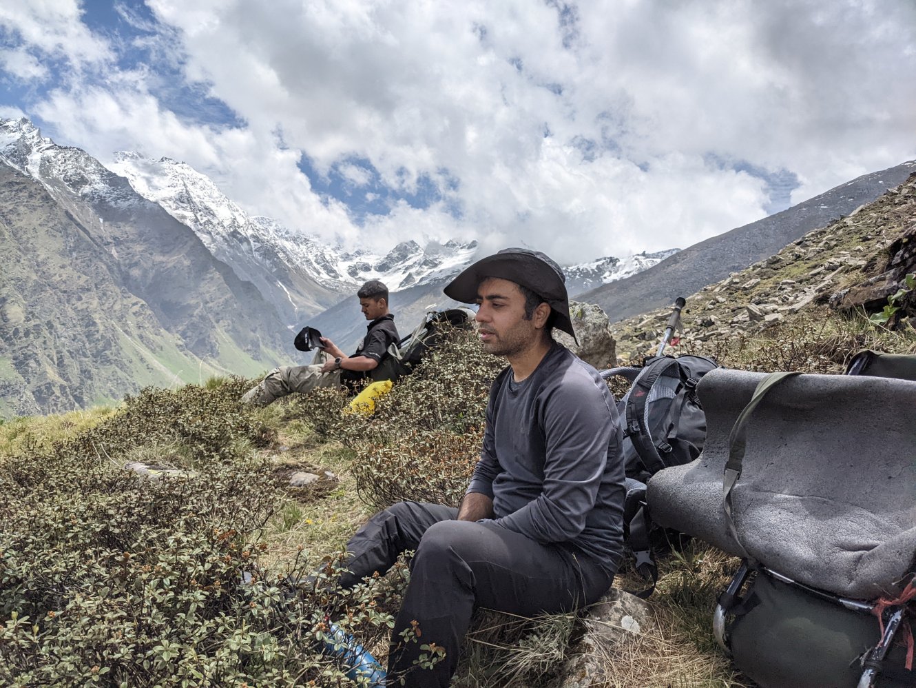 Spot with a view
 The meadow in the centre across the valley is Nada Thatch
Jatholi to Asurbag
The meadow of Asurbag (3800m) was visible from Jatholi, and at first glance, it seemed like a relatively easy walk. We set off around 8:45 AM, descending and ascending across multiple snow bridges across streams. Since the snow bridges hadn’t been crossed by many, we had to cut steps into the ice to safely navigate them. After several crossings, the trail steepened, leading us uphill to a breathtakingly beautiful meadow, blanketed in anemones, primroses, wild geraniums, and a wide variety of other wildflowers. From this vantage point, the vast meadows of Rakhundi, Nada, Dhel, Marahani, and many others within the Great Himalayan National Park were clearly visible. I spent the rest of the day observing the flowers, admiring the glorious mountain vistas, and taking pictures all around the meadow.
Distance covered: 4-5 km, moderate to hard climb
 Step cutting on the big snow bridge
 Reaching Asurbag meadow.
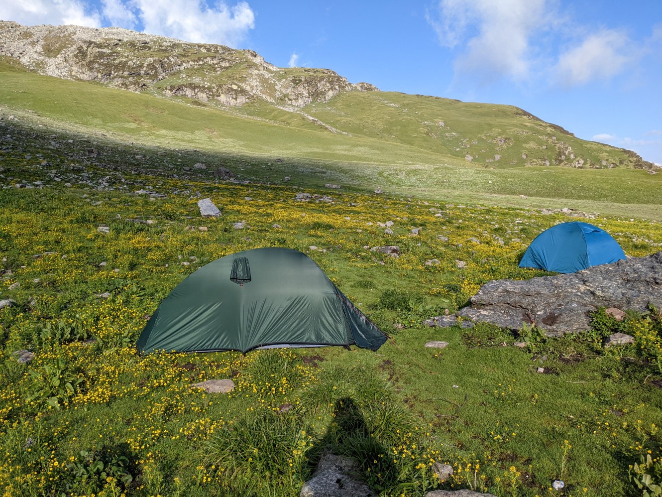 Tents in the meadow
 Flowers everywhere
Jatholi to Asurbag
It was the final day of our trek when we had to cross the pass to enter the Falachan Valley. The climb was slow and laborious, filled with a lot of huffing and puffing as we ascended. We reached the pass in about an hour. On the other side, the landscape changed dramatically, becoming rocky and barren. After descending 100 meters, we continued walking along a ridge that offered stunning 360-degree views of the surrounding peaks.
We crossed another, easier pass, after which the descent became steep and treacherous. The trail turned sharply downward, and navigating the loose rock required extra caution. After what seemed like an eternity, we reached the treeline and descended into a dense oak forest, where the path was covered in a thick layer of fallen leaves. The trail eventually opened up into a peaceful meadow (Bedi Thatch), with a stream flowing through it. We followed the stream until we reached the road by 2 PM. By then, my legs and feet were aching from the steep descent and the long distance we had covered that day.
Distance covered: 10-12 km, hard, mostly downhill, a bit exposed at some points
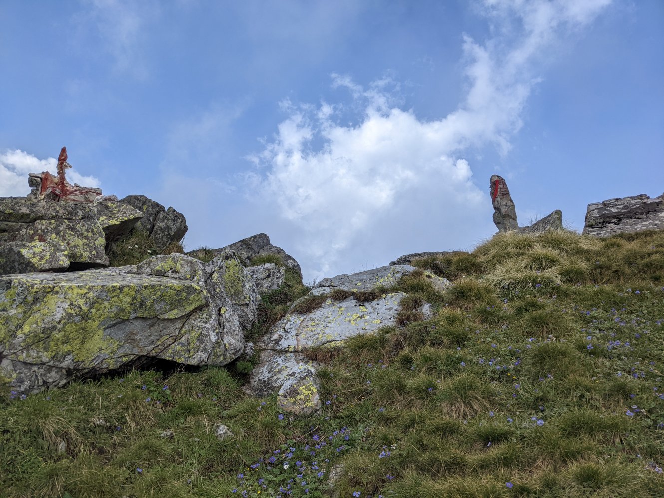 The Asurbag pass
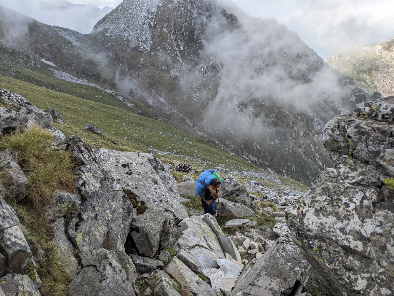 Lady with the load coming up from the other side
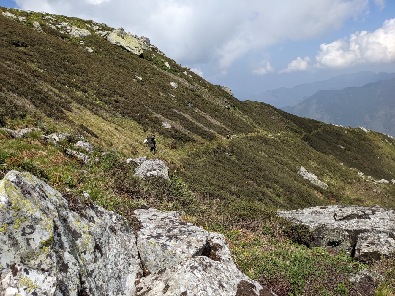 Trail on the other side
 Final pic before the descent
We took a final group photograph and said our goodbyes as the taxi reached to pick us up. The taxi dropped me at my homestay, where I ordered a veg thali with fried local trout for lunch. After the meal, exhaustion finally caught up with me, and I went straight to sleep, tired and content for the journey that had just ended.
Info
-
Great Himalayan National Park – Official website of the GHNP with lots of information about the flora, fauna, regions and history of the park.
-
Himalaya Aura – The trekking operator for this trip, whose owner, Mohan Thakur is a good friend of mine.
Trip dates: 19-24 June 2022